Tongariro Alpine Crossing

loading placeholder image

Please note: DOC is introducing a booking system for the 2023/2024 season, where visitors using any part of the Tongariro Alpine Crossing track should reserve slots in advance. More info here.

8 Hours 20.2 km

Highlights

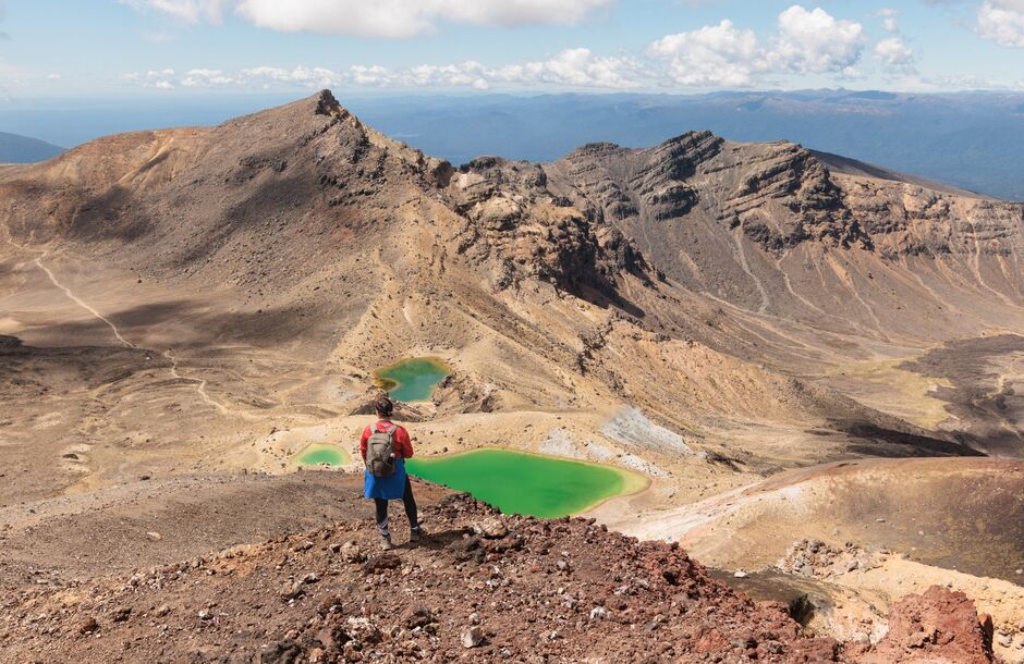
  • Emerald Lakes
  • Panoramic views
  • Volcanic craters and lava flows

Proximity

GRADE: ADVANCED

At peak times this walk can be very busy.

Lava flows, an active crater, steam vents, emerald-coloured lakes and magnificent views combine to make this an unforgettable walking journey.
Ruapehu
Emerald Lakes, Tongariro National Park, Ruapehu

Often described as New Zealand's greatest day walk, the Tongariro Alpine Crossing is a challenging journey across a remarkable volcanic landscape.

For the latest information on access to Tongariro National Park please refer to the Department of Conservation's Tongariro Facebook page(opens in new window).

Track overview

You can walk the track in either direction, but the more popular option begins at Mangatepopo Valley. 

Mangatepopo Valley

Beginning at Mangatepopo Valley near Whakapapa, the track follows a stream and the edges of old lava flows towards the valley head. Look out for varying patches of vegetation that reveal the age of the surrounding lava rock.

South Crater

At the head of the valley, the trail becomes steeper, climbing from the valley to Mangatepopo Saddle between the mountains of Ngauruhoe and Tongariro. Stunning panoramic views look out over the volcanic terrain. On a clear day, you can see as far as Taranaki Maunga (mountain).

Red Crater

The trail leads from South Crater upwards towards Red Crater, the highest point of the Tongariro Alpine Crossing. The smell of sulphur is a reminder that this crater is still active. 

Emerald Lakes

From here you begin the descent, past the stunning Emerald Lakes. This is the highlight of the track and a great place to pause for photos. 

The brilliant colour that gives them their name is caused by minerals leaching from the surrounding thermal environment.

Ketetahi end

The trail continues over Central Crater to the old volcanic vent of Blue Lake, before it rounds the flanks of North Crater and descends to Ketetahi Road end. The final section is a long descent through tussock slopes to cool green forest, a refreshing change to the volcanic landscape.


Plan My Walk app

Plan My Walk takes the guesswork out of your preparation by bringing together the right information needed for planning a safe and successful walk or tramp. 

Plan My Walk - Tongariro Alpine Crossing(opens in new window)

Department of Conservation

Department of Consevation provides detailed information about this trail, accommodation, gear list, and safety information. 

Tongariro Alpine Crossing(opens in new window)

Tiaki Promise - Care for New Zealand

The Tiaki Promise is a commitment to care for New Zealand, for now, and for future generations. 
Tiaki Promise details

Ruapehu
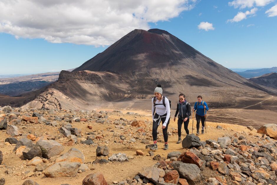
Mount Ngauruhoe, Tongariro National Park, Ruapehu

Planning your hike

The Tongariro Alpine Crossing can be walked in either direction and there are several side trips.

Side trips

  • Soda Springs: 15-minute side trip from the head of Mangatepopo Valley, where you will find an oasis for the moisture-loving, yellow buttercups and white foxgloves.
  • Ketetahi to Mangatepopo: Allow an extra hour to walk the track in reverse.

Getting there

Shuttles

DOC encourages visitors doing the Tongariro Alpine Crossing to book a shuttle or arrange for someone to drop them off and pick them up, because the Tongariro Alpine Crossing takes 7-8 hours to walk and ends on the other side of the mountain.

Shuttles are available to and from the park to the main towns nearby. Shuttle include connections to and from Whakapapa village, Ohakune, Taumarunui, Tūrangi and Taupō. They can be booked at a visitor centre (isite) or online(opens in new window). They can also be arranged with accommodation providers.

Driving

The park is located near many alpine towns. The main entrance to the park is Whakapapa village, located west of the park, near Whakapapa ski field. The town of Ohakune is located south of the park, near Tūroa ski field. Parking space at the Mangatepopo and Ketetahi carparks is limited, first come first served and cannot be booked. There are 4 hour parking restrictions in place and rangers check compliance from Labour weekend in October until May each year.

Flying

The nearest airport to the park is Taupō, located 1 hour and 20 minute drive from Whakapapa village. You can easily combine your trip to the park with a break in Taupō(opens in new window).

Safety on the track

Be prepared

Here a some tips to consider:

  • Fill in an intention form(opens in new window) at the Department of Conservation Visitor Centre if you plan to overnight in a hikers' hut.
  • Take sunscreen and sunglasses, summer or winter.
  • Wear adequate clothing and bring all necessary equipment.
  • When packing for an adventure in the park, be prepared for all weather eventualities.
  • Follow the Land Safety Code(opens in new window) at all times and take the Tiaki promise to care for New Zealand for future generations and protect our tāonga (treasure).

Seasonal information

Alpine weather

The track passes through an alpine environment with changeable weather conditions at any time of year. It is common to experience very cold temperatures, strong wind, heavy rainfall and poor visibility in summer (December to February). Snow can fall at any time of year.

Winter season

During the colder months, from May to late October, there is an increased risk from additional hazards such as snow, ice, avalanche and sub-zero temperatures. To walk the track in winter you will need navigation and alpine skills. Guided walks are also an option.

There are no hazardous weather advisories issued from May to October, so you will need to read the weather forecast and consider whether you have the skills, experience, and equipment for the conditions.

Summer season

During the summer hiking season (November to April), a ‘Not Recommended Today’ advisory is applied to the Tongariro Alpine Crossing when the weather is potentially hazardous. Hazardous weather includes strong winds, sub-zero temperatures, and snow.

The track can get crowded during peak season, which runs from December to February. Consider hiking outside of peak season to avoid the crowds.

Important updates for visitors planning to do the Tongariro Alpine Crossing

Ngāti Hikairo ki Tongariro and DOC want to ensure the experience of walking the Tongariro Alpine Crossing (TAC) protects the fragile environment, is safe, respects the cultural significance of the area, and is sustainable. A new process has been put in place. 

  • DOC introduced a booking system for the 2023/2024 season, where visitors using any part of the track should reserve slots in advance.
  • Bookings are strongly encouraged and are required for booking a shuttle or guided walk.
  • The booking system is now live for bookings 14 October 2023 onwards. You can book here(opens in new window).
  • Visitors who have a Tongariro Northern Circuit hut or campsite booking are exempt from booking through the new system.
  • Visitors can ask staff at any visitor centre to make a booking for them. Visitors will also be able to book a new date if they need to.

The booking system will allow DOC to communicate directly with visitors to Tongariro.

Book your hike

Find Walking and Hiking experiences

Find a place to stay

Arrange transport

Find a tour

You may also be interested in...